CITY PROFILE: Martinez
Martinez is the northern gateway to Contra Costa accessed by the Benicia Bridge. This area is bordered on the west by rolling hills and open space separating it from, Lafayette, Hercules, Crockett, Port Costa, and western Contra Costa. On the north the Carquinez Straits separates it from Benicia and Solano County. To the south is Pleasant Hill and to the east is Pacheco, Avon, and Concord.
While much of the area designated as Martinez for postal and census purposes is an incorporated City, a significant portion is unincorporated with County policing and other services. While distinctly different in some ways, most people view all of Martinez as one community, and most of what I say here is applicable to the entire area.
The area is also divided between two school systems, though not along the same boundaries as the City, so a significant amount of the city neighborhoods attend the Mt Diablo School District, and most of the unincorporated areas attend the Martinez School District. Martinez has its own water system serving most of the area, and a portion of the area is served by a separate sewer district.
Martinez had a significant amount of vineyard and wine production beginning in the late 1800s including the Christian Brothers winery which operated here until the 1930's. Viano Vineyards is still an active winery, and recently new vineyards have been established in Franklin Canyon in the west part of town, south of Highway 4
Martinez benefits from a high proportion of open space, good schools, exceptional freeway egress, affordable homes with ample lot sizes, homogeneous neighborhoods, and a strong sense of community. There is very little land in the city on which to build new homes, so generally, people who want modern amenities renovate homes which were built from the 1920's through early 1970's. However, there are several major subdivisions that were completed in the last 20 years, and numerous small in-fill projects.
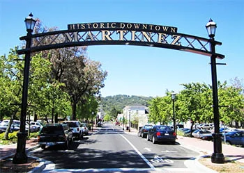
Martinez is the only town in our area with a marina, a winery, and a train station. However, the perception of Martinez suffers from the refinery, which is a blessing and a curse - industrial jobs versus industrial collateral.
Martinez is substantially to the west of the intersection of Highways 4 and 680. There are two typically followed arteries into downtown Martinez, along Pacheco Blvd (off 680), through industrial unincorporated areas, and on Alhambra Avenue (off of Highway 4) in the City proper, through a more manicured commercial strip. The differences are dramatic, and housing values are affected by the proximity to each of these traffic arteries.
Community Maps - Schools, Neighborhoods, etc.
HOUSING:
This discussion gets a bit complex and if you are not familiar with Martinez, this Map Link may help.

Much of the area north of Highway 4 and west of Howe Road, close to downtown, was developed before WWII. This includes the unincorporated Mountain View district, mostly east of Shell Avenue. For the most part, values increase going west from Howe Avenue, with a distinctive difference in the feel of the neighborhoods west of Palm Avenue, where the homes are larger and many have Mt. Diablo views.. Shell Avenue runs approximately along a ridge-line, and to the west are more water-view lots and executive homes. There are some wonderful older neighborhoods west of Bush Street, which could easily be confused with the better parts of Berkeley.
On the west side of this area in Pine Street, which runs from Highway 4 to downtown; the neighborhoods along Pine Street tend to be an exception, as desirability and values tend to be strong all along Pine Street and the adjacent areas. However, values do tend to increase north of Shell Avenue, but taper-down closer to Pacheco Blvd.
Values decline further to the west and closer to downtown with mixed use neighborhoods, but traditionally lower-value street are increasing in appeal as buyers recognize the benefits of walking to town. Homes in the hills east of Pine Street, downtown, are in high demand.
On the west side of downtown, there are many desirable older neighborhoods on both sides of Alhambra Avenue south of the hospital/high school, on both sides of the street, all the way to Highway 4. North of the hospital, Berrellessa Street and Alhambra Avenue are one way streets, traffic on the latter going north toward downtown. Values tend to be stronger on the west side of Berrellessa Street against the hills as compared to directly on the east side of Alhambra Avenue, but many of the classic homes along Alhambra Avenue have become showpieces, where Berrellessa Street has more multifamily buildings including some challenged properties.
The Vine Hill area of economy homes, off of Arthur Road in just east of Town, but known as Martinez by name, was built in the early 1950s. This along with some neighborhoods along Pacheco Blvd., are among the lower priced opportunities for smaller starter homes in Martinez. This neighborhood suffered for years as the corridor for garbage trucks headed to the landfill, but over twenty years ago, the routing was changed, and this neighborhood began to improve. Many of the original flat-roof three bedroom one bath homes have been upgraded and expanded, and several new neighborhood have been built.

Numerous neighborhoods were built along Center Avenue, south of Highway 4, from the mid 1960s through the 1970s, with infill projects later on. A very large townhome project was built along Ashwood Drive in the late 1970s; there is some confusion because this is also known as Vine Hill (the name of the HOA), but has no relation to the area off of Arthur Road. A significant infill project was built on the former Lucky Store plaza at the corner of Center and Glacier in the early 2000s. This area provides a wide range of home sizes and pricing in nicely established and well tended neighborhoods.
One of the most popular sections of town is to the east of Alhambra Avenue south of Highway 4 and to the ridge line of the hills. There are a variety of neighborhoods and home styles ranging from the 1940s to the 1980s, and from eclectic to conventional, but for the most part values are strong. A feature of this area is Nancy Boyd Park. At the peak of the hills on the east side is a large development of town homes from the late 1970s, and to the west a 1990s neighborhood of mostly large executive homes.
The Virginia Hills area to the south is separated from most of the town by the hills, and is surrounded by Pleasant Hill and Lafayette neighborhoods. This area was developed from the mid 1960s to the 1980s. As you pass over the hills coming south along Alhambra Avenue towards the Virginia Hills Shopping Center, most of the homes to the east after the crest of the hills, are in Pleasant Hill and most of the homes to the west are in Martinez. This is a very popular area which commands top values.
A significant amount of newer neighborhoods from the 1970s to the 2000s have been built north of Highway 4 and east of Howe Road, with a lot of recent construction of large homes along Morello Avenue north of Midhill Road near the Viano Winery. Other newer neighborhoods have been built south of Highway 4 off of Pacheco Blvd. and off of Alhambra Avenue. This area varies from newer conventional neighborhoods to eclectic rural sections. Values are typically strong here, though proximity to the train tracks can affect values. Everything else being equal, values tend to be stronger to the south.
There is a large area of estate and horse properties south of Highway 4 and west of Alhambra Avenue in the Alhambra Valley bordering Briones Park. Over the last 20 years, this has become an increasingly more desirable and valuable area.
HISTORY:

In 1824 the Alhambra Valley was included in the Rancho El Pinole Mexican land grant to Ygnacio Martinez. In 1847, Dr. Robert Semple contracted to provide ferry service from Martinez to Benicia, which for many years was the only crossing on the Carquinez Strait. By 1849, Martinez served as a way station for the California Gold Rush. The town was laid out in 1849 by Col. William M. Smith and named for Martinez. The first post office opened in 1851.
Martinez became the county seat in 1850, but could not incorporate at the time because it lacked the 200 registered voters required, and only became a city in 1876. In 1860, Martinez played a role in the Pony Express, where riders rode the ferry from Benicia to Martinez.
In 1915, Shell Oil Company built an oil refinery in unincorporated Martinez, which sparked a building boom in the area. A second area refinery (presently owned by Tesoro Petroleum Co.), together with the Shell facilities, help make Martinez a significant petroleum processing center and port. The oil refineries in and near Martinez can still be seen today from Interstate 680.
Martinez was the home of John Muir from 1880 until his death in 1914. He was buried about a mile south of the building that is now the John Muir National Historic Site (photo right). Also nearby is the Vicente Martinez Adobe, built in 1849 by the son of Ygnacio Martinez.
Folklore claims that the Martini originated on the Martinez Ferry and that it is named for the city.
The opening of the Caldecott Tunnel and a postwar exodus from the urban areas fired tremendous growth in the 1950's. Martinez grew as a result of an exodus from urban areas, but to a lesser extent than Concord and Pleasant Hill, which had relatively small populations until post WWII. While Martinez grew slowly, it retained the small town feeling rather than becoming a suburban culture.
SCHOOLS:

Martinez schools are one of the great success stories of the new millennium. Alhambra High (photo right) has been recently renovated with some sections rebuilt, making it one of the newest facilities in the area. The Martinez School District provides K-12 education for most of the Martinez area including both city and unincorporated neighborhoods. The 2013 district wide API was 837, which exceeds the surrounding areas of: Pleasant Hill, Pacheco, Concord, Hercules, and most of the East Bay, especially in areas of similar home pricing.
A significant portion of the kids in Martinez attend schools in the Mt. Diablo School District, where some of the schools are in common with Pleasant Hill and Pacheco. While overall the Mt. Diablo School District has seen a decline, the schools serving Martinez children are among the best in that district.
Most kids attend Alhambra High in Martinez or College Park (Pleasant Hill) in the Mt. Diablo School District, where the 2013 API ratings are 825 and 817 respectively.
Martinez District
Martinez Junior High - API 844
Morello Park Elementary - API 924
John Swett Elementary - API 895
John Muir Elementary - API 820
Las Juntas Elementary - API 799
Mt. Diablo District
Valley View Middle School - API 805
Hidden Valley Elementary - API 860
Valhalla Elementary - API 869
High Schools Map - Shows State API Score by Location
(Above 900 is excellent - Under 700 is scary)